There’s something incomprehensible about island life to me. No doubt it is largely due to having grown up landlocked, or at least shore-bound, on a massive continent. I felt this when we visited Hawaii in 2016, and I felt it again almost immediately upon arrival in Madeira. It’s a marvel of the global supply chain that this small island is filled with cars, food, durable goods sourced globally fill this island isolated in the middle of the Atlantic, and it has fast, extensive wireless internet and cell coverage as well. All of that is impressive enough on continents, but on remote archipelagos like Madeira, the Azores, Hawaii, Maldives, all of Micronesia, etc. the energy and work required to accomplish these things feels all the more stunning.
It’s hard for my continent brain to imagine life here not feeling isolating, just as, I’m sure, it’s hard for some who live here to imagine being trapped by the land, or a landscape frozen five months of the year.
A tiny car; wild roads
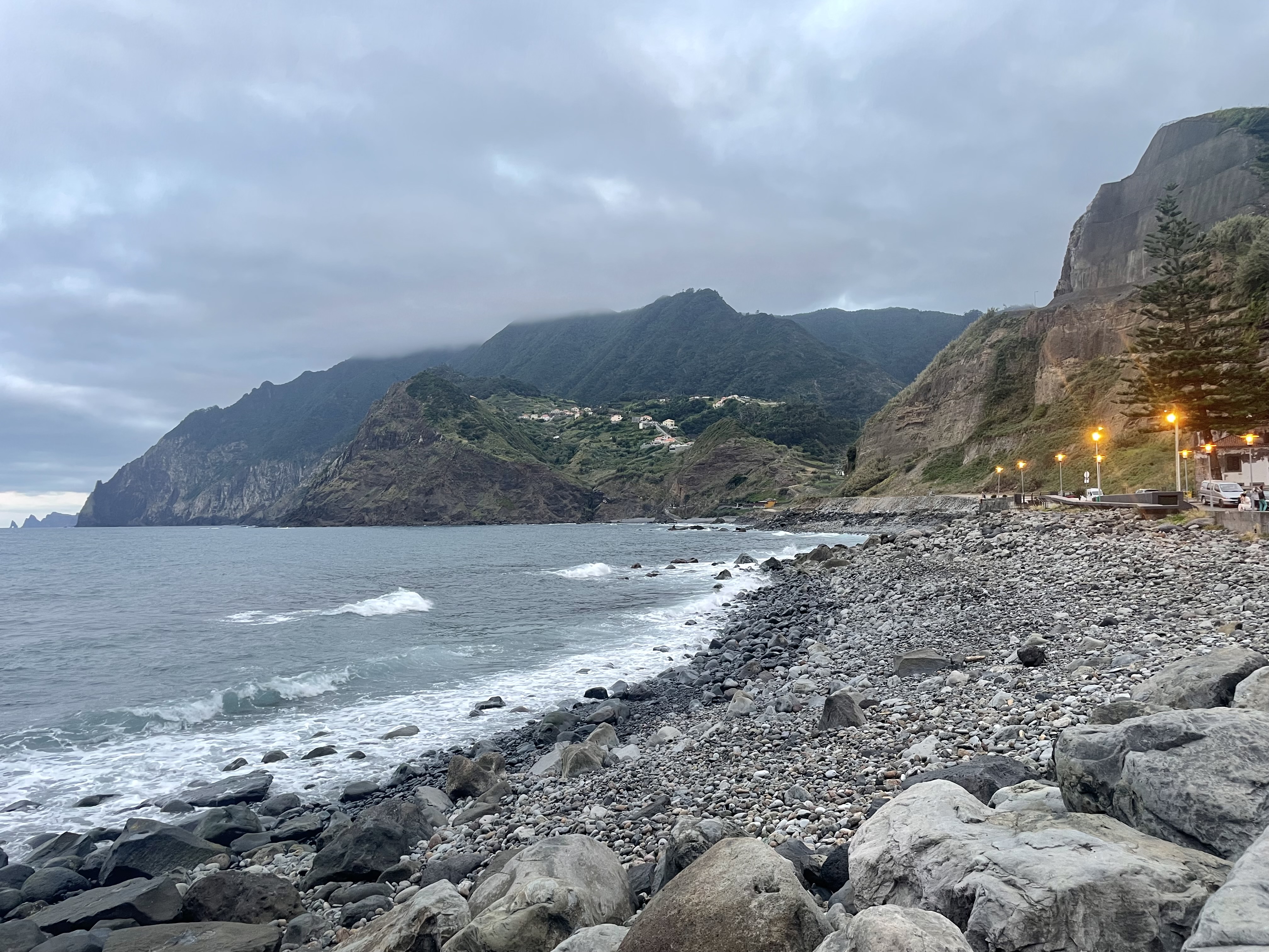
We were on the main island of Madeira for about a week, just Danielle and I. We stayed in a parish community of about 3,000 outside Funchal called Porto da Cruz. We visited Funchal for a day trip, and I think we both agreed we were glad to not have stayed in another city, even if it made our trip a little more complicated (and stressful). If you read about Porto da Cruz, you’ll probably see mention of rugged terrain and by the end of our drive from the airport to our hotel, I really felt like that was an undersell.
There are a few principal highways that tunnel through Madeira’s mountains, some of them are quite long. These drive like any mountain interstate in the US or Europe (though with fewer and narrower lanes than the US). Once off these main highways, though, the terrain becomes less forgiving. I’m estimating the grade between the highway and our hotel was 20% in some spots, and the road was barely wide enough for two cars. It’s steep and windy. There were times we thought we were simply driving into the ocean. We’d turn a sharp corner, drop further and more road appeared. You have to be an attentive and defensive driver, willing to assume a little stress for the sake of your experience.
It was worth it.

Levada walks
An interesting feature of Madeira’s complicated history of land use involves sugar cane, rum, and levadas. There are several major rivers on the island and a network 3,000 km (1800 mi) of irrigation canals that bring water from the source of rivers down the mountains to various destinations and distribute water across the island. Some were built in the 16th century while others were cut in the 1950s and 60s. All of them were dug by rocheiros, who worked from wicker baskets suspended from the cliff. All of them provide drinking water and irrigate the land in the southern part of the island to this day. They’re also part of a hydroelectric power system that will help Madeira achieve 50% renewable energy by 2026.

The footpaths along the canals have a functional purpose: to control the flow of water to different destinations on the island, which means there are relatively well groomed trails alongside all of them. More than two thirds of the island is land protected nature, and the levadas are a great means to access this wilderness and get away from the revving engines of the cities.

The drive from Porto da Cruz to the Levada do Castelejo is steep (At or above 10% for about 2 miles) if not especially harrowing. The hike was about 3.5 miles gently ascending alongside a flowing stream, then back as we came. We were seemingly the only ones on this route, perhaps because it’s easier (some of them can be quite challenging) and it was a nice change of pace from being constantly surrounded by other tourists and traffic.


It’s hard to capture in photos how sheer the other side of these levadas were. The one we hiked wound its way along the cliff side toward Ribeiro Frio, a major river and source of water for several levadas, including this one. If you went off trail toward the cliff, sometimes you’d have a gentle landing a few meters below you, other times you’d be at the bottom of the canyon, a difficult-to-survive fall. Both Danielle and I had to keep our eyes on the trail and canal in front of us, because looking toward the rock below was vertigo-inducing.
Definitely find a lesser traversed levada hike. AllTrails is a good resource, and you can probably find a blog like this one to help your research whether it’s a good fit for you. Wear durable shoes. Maybe bring a headlamp just in case your hike goes through a long tunnel. And really pay attention to your body. Trail descriptions outside the major ones are mixed and rely on what This was a satisfyingly safe and mildly strenuous hike for us, and we only had to be stressed out by the driving for like 10 minutes. Just what we needed after the last few weeks of hot, sweaty, urban hiking


We did a bunch of other stuff around the island as well. On Sunday, there was a trail run that started in our town (with a 50k, 31 mi, length) we observed the starting line. We also went into Funchal to take in the Monte Botanical Gardens, and the roughly 600m ascent by teleférico that took there. Finally, we just relaxed a little: Swam in the sea-water pool, visited the rum factory, and ate some of the best food we’ve had this entire trip.
Speaking of food, I think Wisconsinites could take some lessons on fish fry from the Madeiran cuisine. I had black scabbard with grilled banana three times, and wish I’d had it a fourth. Fresh, well-seasoned fish (feels like the missing piece tbh), lightly battered, and the banana grilled whole (another missing piece) is a perfect combination of flavor, texture, and appearance. Find a place in Milwaukee that fries fish like this and I’m there every week.
Anyway, I do recommend Madeira, especially if have an opportunity to go, you should. While you’re there, ponder the improbability of this island’s existence and human settlements, and mostly: Drive safely and know your limitations. There’s plenty to do, back up plans are easy to make, and it’s not worth getting over your head on a steep-grade road just to see a view of the ocean or a mountain.


A PS on driving:
The rental cars are expensive here and the agencies will likely try to upsell you to a more powerful vehicle. Most of them offer a manual transmission ultra-compact with a 1L engine as a low-cost entry level vehicle. It was plenty powerful for us. But we were just two people with some light bags. My confidence on the road might have limited our experience a tad, but only because I found the narrow roads and steep grades equal parts intimidating and exhilarating. It would have been nice to share the driving with Danielle, but having control over gearing was really helpful going downhill. I’m also not sure what we’d have done with more than the two of us. An EV option would be great for this landscape and chargers are abundant, but don’t splurge on the BMW unless you want to.