Our last few nights in Spain were spent in a camper cabin in the Basque Coast Geopark, a region spanning the coast between the cities of Mutriku and Zumaia that features unique geology. There are 94 such parks Europe (inclusive of Turkey and Russia) and it’s another locally-administered, independently managed, UNESCO joints like the Urdaibai Estuary. This specific one’s featured geology is called the Flysch.
Flysch is the name for a specific geologic formation I still don’t totally grok. From what I understand, it is the result of a phenomenon of plate tectonics and sea water interacting with natural sedimentation. This one occurred when the Istrian and European land masses collided 50 – 10 million years ago (mya) and a keen enough eye can even detect evidence of the asteroid that killed off the dinosaurs.

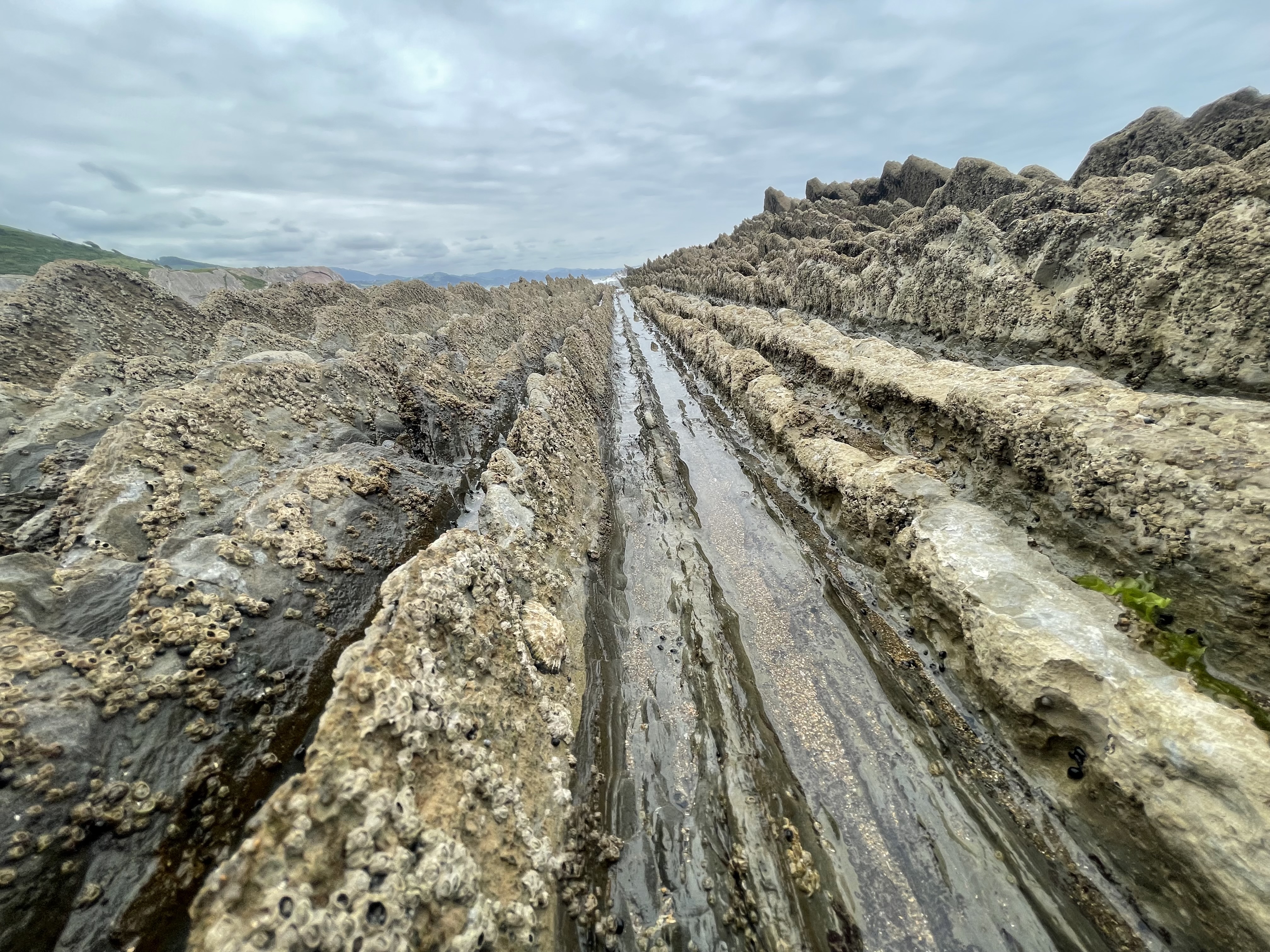
We obviously don’t have a keen enough eye for that. This specific Flysch also stands at the point on Earth where the Bay of Biscay and the Pyrenees mountains were created. At the beach in Zumaia you can observe the Flysch first hand, and the peculiar vertical rock stratification caused by the collision of the two landmasses. As I understand it, that collision created flysch by thrusting upward the layers of limestone, marl, and sandstone that had settled to the bottom of the ocean 100 – 50 mya.
The result at Zumaia was the creation of a kind of geologic calendar where we can now observe the world’s history and read it left to right instead of bottom to top and much of it without doing big archaeological digs. There are a lot of places like this around the globe: Canyons, cliffs, dried up lakes and rivers, anywhere you can observe stratification in rock. Sometimes you can find a golden spike inserted into the rock where two stratotypes separate, and Zumaia is the only place in the world where you can find two of these marking two different stages.

Anyway, enough of the geology lesson. This place is incredible and was about a 15 minute drive from our campground. At high tide the ocean comes right up to these cliffs, isolates one part of the beach from the other, and closes off some caves along the cliffs. When the tide goes out, the flysch along the beach exposes in the form of long, jagged sheets of rock protruding from the sand. As waves roll in they form channels that drive water further inland than the rest of the beach. It’s worth your time to get here even if it’s cloudy and a little chilly.


We spent our final day in Spain hanging out in Donostia-San Sebastian before we caught a bus into the French Basque Country town of Saint-Jean-De-Luz. Tomorrow, the Tour de France begins in Bilbao and is meant to pass right through these places in the first three stages. It’s kind of a bummer we will miss the cyclists but also, I’m not sure how much patience László would have for standing around for a long time to watch maybe five minutes of cyclists. Kinda the hard thing about touring race events.
More on France in a few days!